The municipality of Grândola, within the NUT III – Alentejo Litoral, in relation to the Nomenclature of the Territorial Unit for statistical purposes, has an approximate area of 825.94 km², an extensive coastline of about 45 km, and limits to the north with the municipality of Alcácer do Sal, to the east with Ferreira do Alentejo, to the south with Santiago do Cacém, to the west with the Atlantic Ocean, and to the north and northwest with the Sado River, which separates it from the municipality of Setúbal.
In geological terms, its territory is characterized by three large areas: the Sierra de Grândola, the plain and the coastal strip, which present marked differences in the composition of the soil, the relief, the flora and the landscape in general.
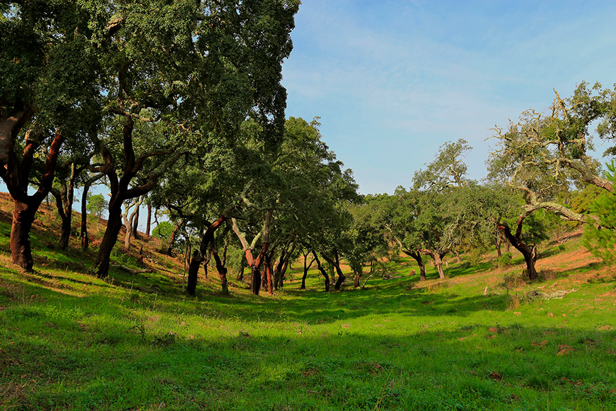
The Sierra de Grândola, about 20 kilometres long and with its highest point on the Atalaia hill, 326 meters high, also extends through the municipality of Santiago de Cacém. Unlike most of the Portuguese mountains, oblique to the coast, this one is parallel to it, it has a north-south orientation, which makes it difficult for sea air to penetrate, although it contributes to the condensation of clouds.
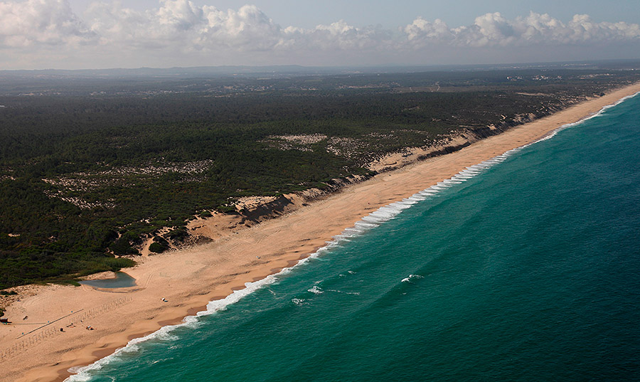
Grândola’s coast. Photo: Município de Grândola
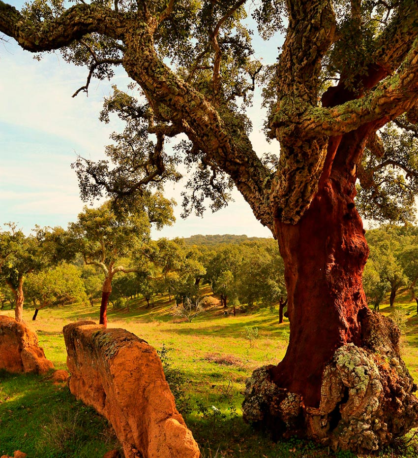
Grândola, with a total area of 82,594ha, incorporates about 22% of its surface in cork oak forests in mass form, which is made up solely of cork oaks, mainly focusing on the Sierra de Grândola area. The forest mass criterion, which appears in the VI National Forest Inventory, defines that forest is “land, with an area bigger than or equal to 0,5 hectares (…) where there are trees (…) and grade of coverage bigger than or equal to 10%.” However, cork forest is also considered from a more global perspective, that is:
• Cork forest in mass form (with higher density of trees);
• Cork forest set up in a non-population manner (with lower density of trees) in a silvopastoral system;
• Formed by cork oaks and other species, specifically the stone pine.
The cork oak forest occupies about 48% of the total area of the county, approximately 39,645ha. Thus, the municipality of Grândola represents, at the regional level (NUT II Alentejo), 6,4%; at the national level 5,4%; and worldwide about 1,8% of the total area of cork oaks.
Empirically, the cork produced in the Sierra de Grândola cork oak forest is often considered, by the most diverse professionals in the cork sector, as one of the best cork in Portugal and even in the world.
The cork oak and cork have always had great economic importance for the region. Currently there are only a few small industries operating in the municipality; however activities such as the harvesting, storage and loading continue to be responsible for hundreds of jobs.
The 20th century was the period of greatest development of the cork industry in the municipality, specifically between the 1930s and 1960s. Dozens of industries of various sizes had their activity in Grândola, the largest having more than 200 workers. In the second half of the 19th century, the first Cork Stopper Buying, Selling and Manufacturing Company emerged in Grândola.
Sierra de Grândola. Photo: Município de Grândola
WHAT TO SEE AND DO
CURIOSITIES…
- Grândola has the 1st approved route in the country: PR 1 Rota da Serra.
- The artisan who obtained the 1st Portuguese artisan license lives in Grândola.
- The acidic lakes of Mina do Lousal are of an extraordinary color.
- The municipality of Grândola has 45 kilometres of uninterrupted coastline.
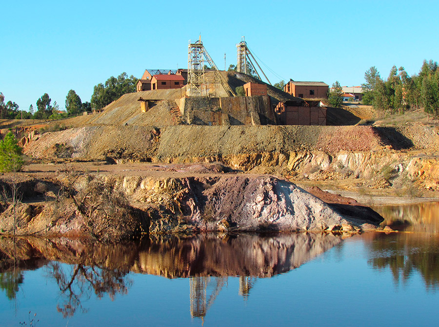
Lousal. Photo: Município de Grândola
Sierra de Grândola. Photo: Município de Grândola
TURISTIC OFFER
MORE INFORMATION
Câmara Municipal de Grândola
Rua Dr. José Pereira Barradas
7570-281 Grândola
T. 269 450 000
geral@cm-grandola.pt
Turismo de Grândola
Praça Marquês de Pombal, n.º 1 n.º 3
7570-139 Grândola
T. 269 750 429
turismo@cm-grandola.pt
 Español
 Català
 English
 Français
 Português
 Italiano
 Deutsch